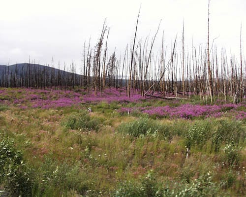
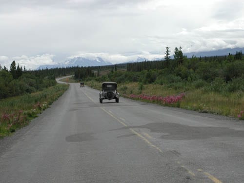
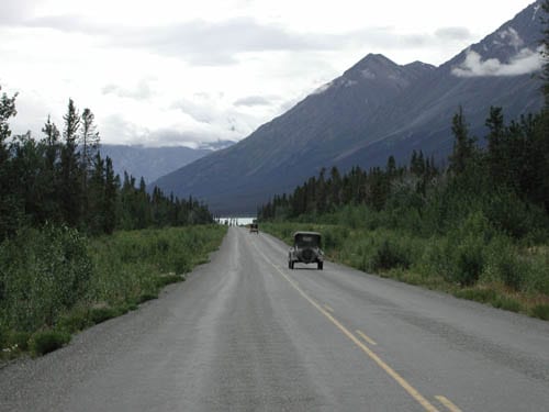
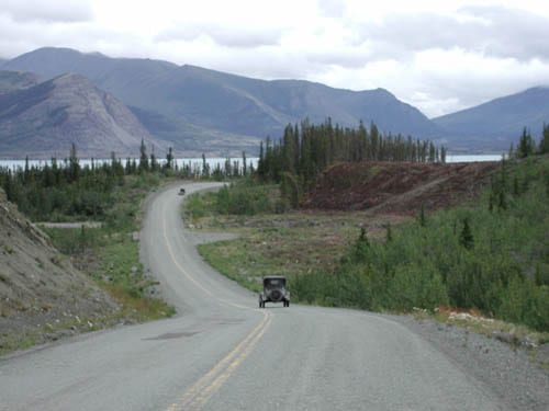
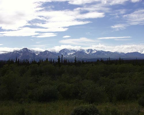
Day 48 – July 23, 2001 – We got an early start (8:00 am) from Beaver Creek. We always set a certain time to be ready to go and we never quite seem to hit it. A friend compares this kind of thing to herding cats. But with a 200 mile day, we can’t afford to spend too much time getting on the road. It has continued raining during the night and we drove most of the day in drizzle. The Kluane Mountain Range ran parallel to the Alaska Highway. Even though some of the peaks are more than 6000 feet, we couldn’t see anything at all except the base. Occasionally, we could see a jagged peak but mostly they were completely hidden by the clouds. We also ran into extensive road construction. The Alcan Highway was built during W.W.II as a means of transporting troops and goods to defend the northern borders from the Japanese. (The Japanese attached some of the islands in the Aleutians early in the war.) The roughness of this road is legendary and the Highway Department is trying to upgrade and, in some places, widen the road. Numerous patches were torn up and we were driving on rocks and potholes again. Ginger was entertaining us with a rendition of “We’re on our way to Prudhoe Bay…”.

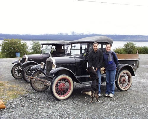
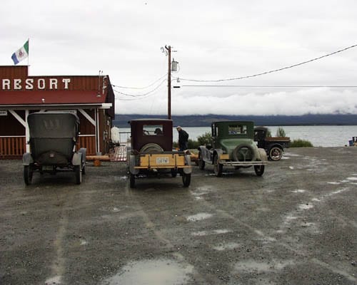
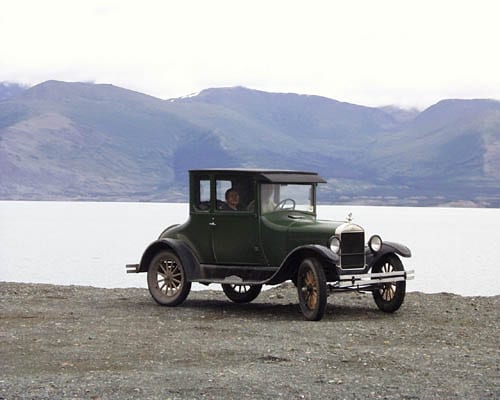
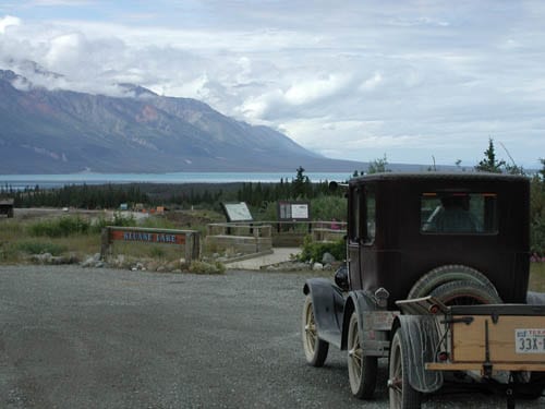
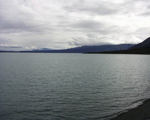
We stopped for lunch at a place called Burwash Landing. Ben and Jennifer had stayed there one night on the 1987 trip. It’s a little of the road but the sandwiches were good and the lake is pretty. We stopped a few others times to take photographs (some of which you will see below) but with the overcast skies, the opportunities weren’t too plentiful. We arrived at Haines Junction around 5:30 pm but it is a pretty small place. The town is literally a junction, a four-way stop with roads leading to the ferries at Haines, Fairbanks and Anchorage, and Watson Lake (further east in Canada). The Kluane National Park borders the community and we spent much of the day driving along or through the park.. The Kluane Range has a tremendous ice field, the largest non-polar glacier field in the world and is a great place if you are into outdoor mountain sports.

We had learned two days earlier that there had been a mix-up in our reservations in Haines Junction so we had made new reservations at a different motel. It wasn’t the worst motel we’ve stayed in thus far but I don’t think they will ever make it in the AAA guide. Our rooms were over the bar.

723a
723a – Jennifer and Ginger Hardeman and their 1926 pick-up truck at Burwash Landing. The girls take turns driving the truck, accompanied by Taylor who loves riding in a truck. Jennifer had more experience in driving a T when we left Bryan and did most of the driving during the early weeks. Now that Ginger has had more time behind the wheel, she drives a part of each day, too.
723b
723b – Burwash Landing is the resort and I use the term by Yukon standards: no pool, no phone, no TV, no air conditioning, no private bathroom, plenty of mosquitoes, lots of rain, lots of fish. The lake was pretty and the food was good – what more do you want from a resort?
723c
723c – Ross Lilleker and his father Bruce from England. At the end of the day, Bruce commented that he had never driven 200 miles in a day without turning a corner. Bruce, like Ross, had never been to the United States before this trip and he hopes to stay with us all the way to our return in Texas. Bruce called his wife Barbara from Haines Junction to say hello. It was 8:00 pm in Haines Junction and 3:00 am in England. Barbara was glad to hear they were alright and hopes that Bruce will figure out the time difference the next time he calls.
723d
723d – We drove past this burn area from a 1998 human-caused fire. Like other burned areas we have seen, the wildflowers have come out in abundance to cover the scar. The fireweed covered this area like a blanket and extended for miles along the highway.
723e
723e – Ginger and Ross ride in the new coupe and stopped at Kluane Lake to take pictures. Everyone has taken turns driving the new car.
723f
723f – The T’s drive along the Alaska Highway (formerly, and primarily, known as the Alcan Highway) as the sun begins to come out later in the day. The mountain in the distance is part of the Kluane Range
723g
723g – Although it is the primary route across this part of Canada, the Alcan is still a two-lane road. If we were doing this in the 50’s, this would be a gravel road. I’m not certain but I think this is Kluane Lake, a lake that is about 40 miles long.
723h
723h – The Alcan was built as a military road so its primary goal was troop and material transport across land which had no means of transportation except water. However, the route they chose is beautiful and as direct as is possible with the mountains and water in the way. There is a little confusion regarding the mile markers. It was laid out in miles and, when Canada went metric, changed to kilometers. Changes in route layout and adjustments for errors have cut about 35 miles off the total distance, changing historic mileage addresses that have been used since the end of the war.
723i
723i – A picture of Ben’s Fordor at the Klaune Lake pull-out. When we pulled of here, Bruce was driving Ross’s roadster. After a few seconds, Ginger called to him on the radio to get over on the right side of the road. This was his first day in driving and American laws were still new to him.
723j
723j – Beautiful Klaune Lake.
723k
723k – The Alcan ran parallel to the Klaune Range. Many of these mountains exceed 6,000 feet but the road stayed pretty level. (I find that to be a good thing; some of the adventurers in the group were hoping for a little more excitement.)
723l
723l – Ben and Ross do a little motel-room mechanics. Remember that new soldering gun that Ben bought from Bruce Campbell? He put it to good use in repairing a damaged distributor.